Sunday, November 2, 2008

Wandering Toward "Home"

Finally, it was time to say goodbye to the family and head south. It was hard to say goodbye because this was the first time I have lived in a different state than they and for the last three years, we had lived only four miles apart and seen each other very often. Now, we didn’t know how long it would be before we’d be together again. After lots of hugs and a few tears, I drove away and for the first time, really felt homeless and alone.

My second night on the road was spent in Twin Falls, Idaho, and I’d definitely recommend it if you’re in the area. There is a tourist center right by the exit with lots of good information from the friendly volunteers there. There is also a path along the rim of the Snake River Canyon with fantastic views. The bridge over the river is one of the highest I’ve seen. The site where Evel Knievel attempted his motorcycle jump across the canyon is a mile away from the bridge, and looking at the canyon, I can’t believe the man was sane to even consider it. The drive to the Twin Falls is a short distance away and frankly, I was a little underwhelmed. The drive there is strictly city until you’re ready to descend to the falls area, then it’s very steep, curvy, and narrow. I believe it’s the first time I’ve used first gear to go down a hill. Once down, the falls weren’t that high and didn’t have much water going over the edge, but maybe that was the time of the year. A large power plant detracted from the scenery as well.

One travel tip I’ve learned from experience: If driving across a high mountain pass bothers you, do it at night. You have no idea what’s out there. After failing to sleep one night in the Salt Lake City/Provo area, I finally gave up at 3:30 and got back on the road. I headed east, noticing that the outside temperature was 54 degrees. I drove up a winding narrow road and eventually noticed it seemed colder in the RV. I checked the outside temperature and it was 29 degrees! After another hour of driving the winding, now-descending road, the temp was back up in the mid 50s. I could only catch occasional glimpses of steep cliffs and high peaks, but not often or clearly enough to be worrisome. Piece of cake!

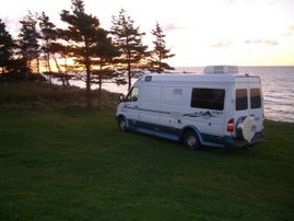
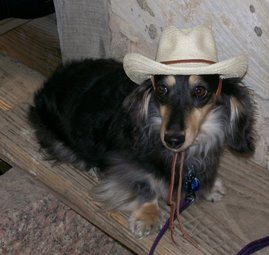
I arrived in Moab later that day and checked into the campground where the Class B RV Rally was going to be taking place over the next five days. That’s the greatest part of RVing: meeting other RVers and renewing old friendships. It was a wonderful five days! Rallies are fun, but they can also be very tiring, even for dogs…

During that time I visited Arches National Park twice, but road work kept me from seeing as much of it as I would have liked to. What I saw was beautiful, though, and the Interpretive Center was outstanding. The mountain range visible from the campground was snow-free while I was there, but the night before leaving, a rainstorm came through the area, and the next morning, the mountains were snow-capped! Quite a surprise, since the temperatures down at the campground were only in the low 50s.

After leaving the rally, I followed the route recommended to me by one of my friends familiar with the area. It was a great recommendation and I’ll pass it on here in case you’re ever out that way. From Moab, drive north to I-70, then south on Hwy. 24.Continue on 24 to Torrey, then turn south on Hwy. 12. Allow yourself a LOT of time to travel the approximately 124 miles along Hwy. 12…not only is it a winding, up-and-down road, but it’s so beautiful that I found myself stopping very frequently for picture-taking and just to drink in the views. I had never heard of the Grand Staircase Escalante National Monument prior to this trip, so it was one of the wonderful surprises along the way.

I arrived at the entrance to Bryce Canyon National Park not too long before sunset and the campground was full, so I went along to another beautiful campground farther along the way and planned to come back to Bryce Canyon the next day. The public campground I found was in Red Canyon, in the woods with a gorgeous view of the canyon walls. I parked next to a very nice couple who were celebrating their anniversary that day, and was invited to join them for a glass of celebratory wine around their campfire. There were no electric hookups at the campground, so I was careful not to use anything except for a light that was only on for a short time. I knew my battery was weak and that I’d need the furnace in the morning. (The propane furnace needs electricity for the fan.) I set the thermostat for 58 and went to sleep. At 5:00, I woke up in a very cold camper to the low battery alarm. It was 45 degrees inside and 27 out! I started the engine and warmed it up with the van heater while I dressed and packed up to leave. At that point I decided I needed to get down to lower altitudes, so I missed Bryce Canyon. Next time, I hope!

Wednesday, October 22, 2008

Homeless in Seattle

Well, a lot has changed since the last post and I'll try to catch you up without too many boring details. When I last posted, I was getting ready to sell my house and buy in Arizona. While experiencing first hand the housing woes of America, I finally managed to sell the house after the first "buyer" backed out on me two days before closing. My house reduced in value by 21% over the three years I lived there, but hey, it's over and I'm moving on. That sale has closed and the new house won't close until the beginning of November, so I truly am homeless. Except for my little castle-on-wheels, that is. It's serving me well, and the dogs love being with me pretty much 24/7. So much for the background; now for the travel journal entries:

I left Minnesota on August 4th, accompanied by my daughter Shar, her father-in-law, and her two daughters (Kendra and Annika) in her SUV. My grandson Jake rode in the MUTT with me and was a great navigator and traveling companion. We drove across North Dakota and Montana; eastern ND is crop country—wheat, barley, sugar beets, oats, and so on – and then in the west it turns into grass country, which continues across Montana. I have never seen so much hay in my life! It was mowing & baling time evidently, because every field had bales as far as the eye could see.

We headed south in Livingston, MT and headed down to Yellowstone. I won’t go into much detail here since I can’t add anything much to all the prose and drivel already written about the Grand Old Park. The only original kick I got out of the visit was when a car going way too fast roared past me in the 25 mph zone, then around several other cars. I told Jake that people that drive in a tourist area should expect slow traffic, and then a cop zoomed past us with siren and lights and sure enough, we soon passed the speeder and cop on the side. Justice can be so sweet!

The drive from Yellowstone to Washington was beautiful: mostly mountainous and forested. I entered Idaho for the first time in my life and want to go back some day to explore Coeur d’Alene in detail. Washington is a state of several different climates, much like Texas. There are rain forests, deserts, mountains, and of course the coastal region. I spent almost eight weeks there, most of it at Shar’s, but also took side trips to the Olympic Peninsula and the ocean, as well as a couple campgrounds in the Cascades. I crossed Snoqualmie Pass four times and was awed by its beauty as much the fourth time as the first. Unfortunately, I was driving each time and the curves and climbs didn’t allow for as much gawking as I would have liked. Washington is truly a beautiful state and I’m hoping to get back there each year to visit the family and see even more of what it has to offer.

The trip to the Olympic Peninsula I mentioned earlier was with my friend Laura and her family. They have a beautiful vacation home overlooking Discovery Bay and we went on a great hike in the woods, ending with a beach walk, with the bluffs rising above us. We also visited Fort Worden State Park, again hiking through the woods and old abandoned battlements. The fort was built to protect the Puget Sound from invasion and is one of four forts that face the mouth of the vulnerable waterway from all directions. The day couldn’t have been more beautiful, with great scenery and a lot of informational markers along the trails.

While staying in WA, I took another side trip to travel down the Oregon coast. I’ve been told many times that if I loved the WA coast, I’d be blown away by Oregon’s counterpart. Wow, were all of them right! I met a couple friends of mine there and spent four days traveling down about a third of the way down the state. Pat and Jan were also traveling in an RV, so we stayed at campgrounds together and caravanned during the days. The last night before we split up, we stayed at a state park right on the beach. I walked down and watched the sun sink into the water that evening and learned about the custom of raising a wine glass in a toast to the sunset. Next time, I’ll be sure and bring a glass to raise myself! The next morning, I was on the beach early enough that I had it pretty much to myself, so I could let Rave off leash and let him run. He was in doggy heaven! (By the way, my side trip to Oregon filled up my US map…I have now been in all of the lower 48 states!)

This is getting very long, so I’m going to end here for now and continue on to the next leg of the journey in my next post. I promise there won’t be as long a time gap as between this and the last one!

Saturday, March 1, 2008

2008 Winter Trip Wrap-up

I last left you as I watched the golf carts go by, sitting in the sun and heat. Yesterday I was scraping ice off the windshield of the MUTT prior to putting it back in storage, so I thought I should fill in the gaps before closing this chapter of my journal.

I went from the River Bend Resort to South Padre Island to spend the day before checking in to my next resort. I was amazed at how much construction has been done and how much continues to be done on the island. In only four years since I have been visiting there, the edge of construction has extended several miles up the coast.

SPI is the southern-most town on Padre Island, a very narrow barrier island off the eastern coast of Texas. Padre Island is actually 130 miles long, but because of breaks caused by areas below sea level, it consists of a series of separate land masses. The farthest south land mass, which includes SPI, is about 35 miles long and only about 1/2 mile in width. (I'm estimating these distances, so don't use them in a college essay!) After leaving the occupied area, the road continues north for several miles and has beach access roads every mile or so. After the road ends, the remainder of the island is undeveloped.

As I've done on previous visits, I drove up the shore about five miles before turning into one of the beach accesses. I've gone this far to have a more isolated beach on which to walk the dogs, but my mistake this time was to go on a Saturday afternoon. The normally quiet beach was converted to a freeway for 4-wheel-drive pick-ups, the sand packed down by all the traffic where it was hard enough, and deeply rutted where it wasn't. I tried to walk the dogs, but gave up after a short time, worried that one of them would veer off to the side as a truck whizzed by.


On my way back to town, I stopped at the Laguna Madre Nature Trail where boardwalks weave through four acres af wetlands. There were lots of birders on the boardwalk, and they looked at my dogs with glances that said, "Those animals better not disturb the birds!" I'm happy to report that the dogs were very well-behaved and never made a sound.

After my SPI tour, I went to the RV Resort I had visited last year, Winter Haven in Brownsville, and spent a very hot two days there before starting the trek homeward. When I left the resort Monday morning, the temperature was already 79 at 9:00. It got up to 93 by the time I reached San Antonio and was still that high when I hit Austin at rush hour. Travel advice: Do NOT attempt to drive on northbound I-35 through Austin during afternoon rush hour! There are no alternate routes and it was terrible! Bumper-to-bumper traffic, frequently at a complete stop, for what seemed like days. In actuality, it took me an hour to go about fifteen miles. I was worried about the engine over-heating, as the temp was still in the mid-90s, but even though my interior thermometer said it was 124 degrees (pretty sure that was wrong!), the MUTT made it through without a problem. I spent that night just north of Fort Worth and by the time I went to bed, the temp was in the 40s. The next morning it was 39, and after that, it was all downhill. However, the skies were clear all the way home.

I'm now sitting surrounded by piles of papers and files as I try to get ready to put my home on the market. Next trip will be the B Social Rally in Nebraska in June. Until then, I'll be stuck in the house throwing, packing, and otherwise ridding myself of years worth of accumulated stuff. Thanks for "joining" me on my winter trip and stay tuned for the next edition

Friday, February 22, 2008

If Only I Golfed...


I'm spending today and tonight at the fabulous River Bend Resort and
Country Club in Brownsville, TX! Every home and RV spot abuts the
golf course, spread out among the holes. I'm parked right by the 6th tee and with the beautiful weather, the golf carts are going by as though there's a parade. There's a very inviting pool in front of me
that I plan to jump into soon. With temps in the mid-80's, I really may jump in instead of doing my usual inch-by-inch 10-minute pool entry. Too bad the dogs can't swim, but they're enjoying the air conditioning in the RV.

The Resort is right on the Rio Grande river, and a person with a good throwing arm could easily throw their golf ball into Mexico. I'm betting a fair number of balls end up there if the golfers have bad hooks or slices!

Thursday, February 21, 2008

Texas Revisited

I realized that in my last post I skimmed over my time in Texas, so decided to fill in some details.

I spent three nights at an RV Resort in San Antonio, mostly relaxing, but busing into town one day to revisit some of my favorite things in one of my favorite cities. I enjoyed pizza and a beer while sitting on the Rivercentre plaza, watching the tourist boats go by and listening to the pilots' spiels. I fed pizza crust to the birds and was soon surrounded by pigeons, sparrows, and grackles. Some baby ducklings came by to see what the fuss was about, but I found out that they don't like bread. That was a big surprise!

After my lunch with the birds, I once again strolled along the River Walk. I did discover one place I hadn't visited before, a small art colony abutting the river. I believe it was named "La Villita," meaning Small Village, but I might not be remembering that right. (Kind of disturbing, how often that happens these days.) Anyway, it's very quaint and historic-looking, hidden away in the middle of the big city. There are many artists and artisans creating and displaying their wares in small shops. If you're on the Riverwalk, look for the broad rows of steps, like an amphitheater, and walk up to the top. La Villita will be right in front of you.

While in San Antonio, I visited a sister community to the one in Tucson and while it was beautifully laid out and had even more amenities than the one where I'll be living, it was so spread out that I didn't feel it would be as easy to meet people there. Also, San Antonio is a three-day longer road trip to visit the family in Tacoma, so that was a huge reason to stay with Tucson.

After leaving San Antonio, I went on to an RV rally in Kerrville where I met up with my friends Sally and Ron and met many others. Tip of the day: If you're in or passing through Kerrville, I highly recommend Mamacita's Restaurant. Excellent Mexican food and ambiance!

I moved on to Port Aransas after the rally and stayed a couple of days with my friends, Sam & Alice. While there, I walked the dogs on the beach and as I expected, it really made me miss Pacer. She loved the beach so much! I discovered, though, that memories of ones we have lost hurt for awhile after the loss because they remind us of what we've lost, but later on, they remind us of what we've had. I think I'm entering that stage now with my memories of Pacer.

I'm down in the Rio Grande Valley now, watching the weather forecasts and waiting anxiously to head home to MN. It was 85 degrees here today, and very humid. About 75 degrees warmer than at home!

Thursday, February 14, 2008

Gonna Be Going a New Direction Soon...

...north for the summer, instead of south for the winter. Yes, I'm relocating to Arizona from Minnesota, contingent on selling my townhouse in Lakeville. I've paid earnest money for a house in an "Active Adult" community in Sahuarita, AZ, a small city just south of Tucson. It won't be finished until November-December '08, so that gives me quite awhile to sell the house.

The background of my decision started with my son-in-law accepting a position in Tacoma, WA, so Shar and Jeff are moving there this summer and they're taking my grandkids along with them! I considered relocating with them, but for a number of reasons decided against it after some serious soul searching. However, there was no longer a reason to stay in Lakeville and I was worried about living in a two-level townhouse as my back deteriorated, especially without the family there to help me when it became necessary. So the townhouse would be going up for sale regardless of any other decision I made. What I should do next was the unknown and the source of a lot of stress and sleepless nights. Some of the options I considered were renting in WA for 6 months or a year to see how I liked it, buying down south in AZ or TX and spending the summers driving around, or ???

I decided to still make my trek south this winter, starting in AZ before going east to TX. One of my stops was to visit friends in Sahuarita. I immediately fell in love with the over-55 community my friends lived in. The houses are very small but well designed and attractive, and the small back yards are totally enclosed within a five-foot tall solid stone fence. It keeps the dogs in and the critters out! There is a community center with meeting rooms, exercise rooms with a 70-channel TV on each machine, a library/media room, etc., etc. Outside are a large outside pool and whirlpool, putting green, bocce ball courts, etc., etc. Lots of planned activities and trips. All the people I met were very friendly and enthusiastic about their community. The whole area is a new, planned community with over 100 miles of trails and new shopping areas. One of the big selling points was the presense of two dog parks in the community...one for large dogs and the other for small!

So now I'm in TX waiting for the weather and roads up north to clear up enough to let me safely drive back to MN and start the cleaning/packing/ tossing process.

Tuesday, February 12, 2008

Arizona & Texas, 2008 Version

Welcome back! I’ve been on the road for two weeks already, but wasn’t able to get into my blog until now. I reversed my route this year, going first to Arizona for about two weeks before heading to Texas. The temperature in MN when I left was hovering around zero, but at least it wasn’t snowing. The weather driving south was great…no snow, ice, or rain all the way. It did rain a couple times while I was in Ajo, but the heavy rain was in the middle of the night and the rest was just showers. The next five days were completely cloudless and warm. I’m in Texas now and the clouds have moved in as well as a forecast of rain the next couple days.

Ok, the weather woman is done. Now on to the travelogue. I spent a week with my friends Julie and Sandy in Ajo, AZ with beautiful warm days and chilling nights. We took a day trip to Rocky Point, Mexico on the shores of the Sea of Cortez (or the Gulf of California, if you prefer) where we window shopped (ok, there weren’t any windows), ate authentic Mexican food (except for Sandy, who had pancakes), and walked on the beach. The water was a beautiful aqua color and the shelling was wonderful...made me long for the week-long Mexican vacations I’ve taken in the past. If you find yourself in Ajo, ask someone about the scenic circle drive. It makes a large circle to the immediate south of the town, passing through some beautiful views of the mountains and millions of cacti. I became completely enthralled with cacti on this trip and am determined to learn as much as I can about them. I must have been a desert rat in a previous life!

Next, it was on to Tucson and a stay at my friends Jack & Judy’s house in Sahuarita. They live in a beautiful over-55 community with a club house offering lots to do. The homes are all single level with stone-fenced back yards. The dogs loved being able to go outside without leashes, both in Ajo and Sahuarita. Jack & Judy’s dog, a very cute Border Terrier named Effie, quickly established herself as alpha dog and it took a couple of days for them all to work it out, but by the time I left they were getting along fine.

During my stay in Sahuarita, we went to a craft fair at the local casino. There were some very interesting items, but by far my favorite was the booth of a former middle-school science teacher named Delight, and her husband. Delight created jewelry based on her love of science, such as a necklace representing the solar system with various sized beads for each planet and the asteroid belt. The head of the wearer is the sun. It would be great for a person who thinks the world revolves around them! She also created a double-helix necklace, a coral snake necklace, and more necklaces of all the constellations comprising the astrological signs. All of them were as technically accurate as the limitations of her media could make them. She and her art would make a very interesting magazine feature!

After leaving Tucson, I started the trip east to Texas. It’s not too bad in AZ and NM along that road, but once you pass El Paso, it’s many miles of nothing. I found out exactly how far when I failed to check my fuel gauge and saw with dismay that the warning light was on and I had gone 511 miles with a 26 gallon tank of fuel. Since my mileage hasn’t been as good as normal with the high winds and higher speeds (high is 80 mph in west TX!), I was pretty concerned. Service stations are few and far between there and I decided to stop at a rest stop and see if anyone knew of a station off the highway, or if I should just keep going with no towns in sight.

At the rest stop, I went up to the first truck driver I saw and told him of my predicament and asked if he knew where the closest fuel was. He told me it was in Ozona, about 30 miles on. I said I didn’t know if I could make it that far, and he told me to go on ahead holding my speed to between 55 and 60. He said if he saw me on the side, he’d stop and take me to Ozona. Well, he caught up to me, slowed down to my speed, and followed right behind me. It must have driven him crazy to go that slow…time is money to those guys! When we started down the interstate, I saw a sign that said it was actually 56 miles to Ozona …no way I was going to make it!

After what seemed like hours, my trucker friend pulled in front of me and indicated I should pull off at the picnic area ahead. When we met there, he said he had an idea. He cut off a piece of a hose he had with him, poured the water out of a couple gallon jugs he had, and siphoned fuel from his tank into the jugs. Then he cut the bottom off of a water bottle and using it as a funnel, poured the fuel into my tank. I gave him $20 and he said a kiss on the cheek would have been enough. I told him he was my guardian angel and I would be eternally grateful to him. He said he had been an eagle scout and a scout leader, and that helping people was drilled into him. He also said he was a Missouri hillbilly and was a descendent of the Hatfields of the Hatfield/McCoy feud. He was a short, grizzled man around my age with a halo over his head His name was Chester Hatfield and I gave him that kiss on the cheek before we parted.

I’m in San Antonio now, sitting out some rainy, windy weather before heading to an RV Rally in Kerrville, TX. I’ll try not to wait so long before posting next time!